Search
Items tagged with: Openstreetmap
Here's a new #tool to help fight #disinfo and facilitate #verification:
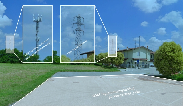
SPOT is an #AI-driven natural language interface for geospatial searches in #OpenStreetMap. 🗺 🔍
Fetch an image you need to check.
Identify an info pattern.
Provide instructions: "Show me a parking space within 200 meters of a communications tower and a power pole in Legnago, Italy".
Receive a really good result on an interactive map. 🙌
Details & a call for beta testers in this post: https://innovation.dw.com/articles/geolocation-verification-with-ai-our-solution

Geolocation verification with AI tools, what's our solution?
Can AI help with geolocation verification? Ruben Bouwmeester and Tilman Wagner explain why and how DW Innovation has built their own tool that does exactly that.innovation.dw.com
There is a nice @openstreetmap #Openstreetmap #OSM printing service available at #FrOSCon2024 #froscon19 #froscon
You can select an area for which you want a map and can then print it.

